
Prairie Weather (Rural Roots Canada) – Excellent harvest weather continues across the prairies going into the long weekend
Harvest conditions look excellent going into the Labour Day Weekend. A strong ridge of high pressure will keep the prairies warm and dry. In some cases, hot and dry. There will be a few anomalous showers from time to time – details below.
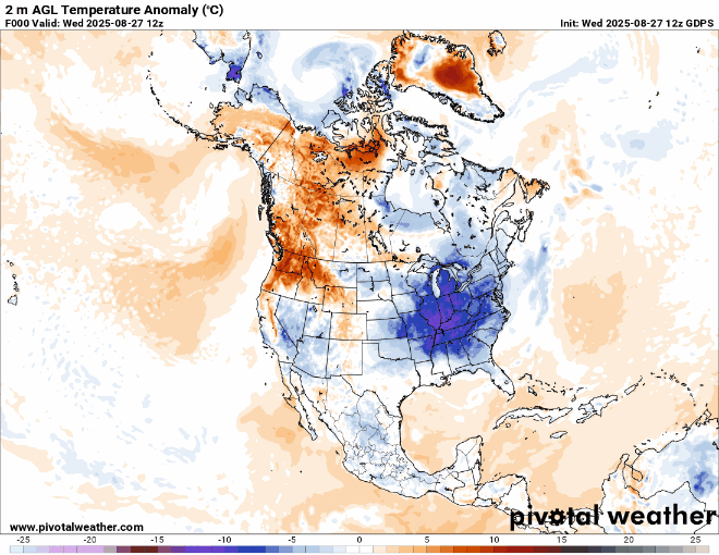
The main story, though, remains the heat. The animated map below shows temperature anomalies for the next 10 days. Where it’s blue, it’s cooler than average. Where it’s orange, it’s hotter than average. Western Canada stays orange through the period:
Thursday
Alberta, Saskatchewan, and Manitoba
After three straight days of unchanging weather, here’s the fourth. High pressure aloft and at the surface means more sunshine, light wind, and above average temperatures. . But this time, there is something to watch….as a low begins to spread rain into northern Montana, and heads for the Canadian border. Until then, Thursday is sunny and dry across the three provinces. In Alberta, the area of 30 degree high temperatures moves north into central and northern Alberta. The Montana low will draw some cooler air into southern Alberta. Brooks and Medicine Hat are still candidates for the high 20s and low 30s. However, in the Lethbridge area, highs are more likely to be in the 20s, as the sun will be blocked by cloud pushing northward from the Montana low. There is a slight risk of isolated thunderstorms along the eastern slopes of the Rockies. Dry and sunny weather continues for Saskatchewan and Manitoba. Similar to earlier in the week, Saskatchewan will reach highs in the high 20s or low 30s, and Manitoba could hit 30 in the west, and the mid 20s on the eastern side of the province.
Friday
Alberta and Saskatchewan
This is the only day this week where precipitation is expected anywhere on the prairies. And at that, it’s not much. Friday night, expect rain in southeastern Alberta, as shown on the map below:

The rain is coming in from a disturbance centered in northern Montana. Amounts will be well under 10 mm. The rest of Alberta and Saskatchewan will stay dry. In the Cypress Hills, highs will only get to the mid to high teens. Most of Alberta and Saskatchewan will reach the high 20s, with 30 degree temperatures possible in central regions of both provinces.
Manitoba
As the map above shows, Manitoba will have another dry day with temperatures across the province reaching the low to mid 20s.
Saturday
Alberta
The upper ridge remains in place, which means another sunny, hot day for Alberta, with highs in the high 20s to low 30s. Some terrain-induced instability may cause some thunderstorms to form over the foothills in the late afternoon. They are expected to break apart as they try to drift eastward in the evening. While there will be no significant rainfall totals over agricultural land, the showers may briefly impact evening harvest operations.
Saskatchewan
Saskatchewan will be sunny with the exception of the southwestern part of the province, which will see considerable cloud cover. Highs in the south will range from 28 to 32 degrees, with highs in the mid 20s for northern Saskatchewan. Good harvesting progress will likely be made in Saskatchewan on Saturday, though heat may accelerate crop ripening.
Manitoba
Not a drop of rain is expected anywhere in Manitoba, with highs across the province ranging from 27 to 30 degrees under the influence of a powerful ridge of high pressure.
Sunday
Alberta
The ridge of high pressure will weaken slightly, and this could lead to light scattered showers in central Alberta and along the foothills. However, with the atmosphere being both hot and dry, there is a good chance the showers will evaporate before reaching the ground. Widespread rain is not likely. Temperatures will range from 287 to 31 degrees.
Saskatchewan
The upper ridge begins to flatten, but there won’t be any significant change to the weather down on the ground. In other words, it’s another sunny, hot day in Saskatchewan, with highs of 287 to 30 degrees in the south, and the mid 20s to the north. Toward evening, some showers and perhaps thunderstorms, may pop up in central Saskatchewan between Saskatoon and the Manitoba boundary.
Manitoba
It’s another warm day for Mantioba, with highs from 26 to 29 degrees. The province will again be mainly sunny, but a weak disturbance brushing central Manitoba could trigger clouds and showers, especially in the northwestern part of the province. Elsewhere, rain chances are low. The agricultural south will remain dry, and excellent harvest conditions continue.
And finally……
A reality check.
Hot weather at the end of August on the prairies is not at all unusual. Nor is snow, at least in the far north. Here is Environment Canada’s significant weather chart for Thursday, August 28:

READ: Farmers Reeling After Hail and Wind Wipes Out Crops Near Brooks.
